Та дорога в гору в горном Чунцине научила меня не недооценивать городской рельеф
The first time Chongqing’s terrain truly taught me a lesson was on an ordinary-looking afternoon. My phone map said the distance from near Jiaochangkou to the small hotel I had booked was a little over one kilometer, about twenty minutes on foot. I looked at the curved but not very long blue line and thought it would be a good post-meal walk. Chongqing waited for my mistake quietly. It did not write “you are about to lose your breath” on the map. It simply hid elevation inside a thin line.
That day I had just finished a bowl of Chongqing noodles, with the numbness of Sichuan pepper still in my mouth. My backpack held a camera, a power bank, and a bottle of water. Steam drifted from small restaurants, laundry poles reached out from upper floors, and a bus turned through the intersection with a gust of air behind it. I followed the navigation, and the first few hundred meters felt normal: the sidewalk was narrow, electric scooters slid past me, and the traffic lights changed quickly. Then I saw the road ahead suddenly lift its head.
It was not a polished slope inside a scenic area, nor a photogenic stone staircase. It was an everyday uphill road, lined with a fruit shop, a pharmacy, a key-repair stand, and tightly parked cars. Because it looked so ordinary, I did not first treat it as a challenge. I simply put my phone in my pocket and expected to finish it in ten minutes. In less than two minutes, my pace changed from a traveler’s lightness to an energy-saving mode that local commuters understand well.
Chongqing’s uphill roads are not only about angle; they are about continuity. You think the road will flatten after the next streetlamp, but there is another bend beyond it. You think you can rest after the bend, but a narrower slope follows. You think the distance on the map is shrinking, while your body tells you the height is still increasing. The map calculates distance on a plane. Your legs reinterpret distance through gravity.
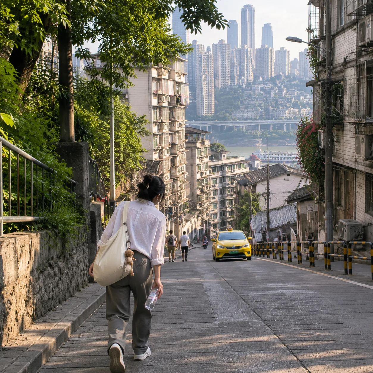
Halfway up the slope, I stopped in front of a convenience store and pretended to look at drinks. I was not especially thirsty; I simply needed a reason to stand still without looking defeated. There were two steps at the entrance, and an auntie sat there peeling an orange. She looked at my backpack, then at the sweat on my forehead, and smiled: “Still a while to go upward.” It was not mockery. It felt more like a Chongqing resident’s gentle warning about terrain.
I bought a cold bottle of water and checked the map again at the store entrance. The navigation remained confident, the blue line remained short, and the remaining time was now only fifteen minutes. But for the first time I noticed the small gray lines, staircase symbols, and the directions of road names nearby. In Chongqing, you cannot read a map only by length. You have to see how lines wrap around the mountain. A destination that is “near” may be far from you vertically.
As I continued upward, I began to study local body language. Office workers in leather shoes did not charge straight up; they kept a steady rhythm with small steps. Delivery riders slowed before the slope, judged the oncoming traffic, and only then turned the throttle. A young father pushing a stroller chose the rougher but gentler side near the curb. An elderly person carrying vegetables stopped every few steps under tree shade, resting naturally, not as if surrendering.
I suddenly realized that Chongqing residents walk with a kind of advance allowance for terrain. They do not wait until they are tired to adjust; they change stride, route, and breathing as soon as the slope begins. A common mistake for visitors is bringing flat-city walking habits into a mountain city: speeding up because the distance looks short, entering an alley because it seems direct, and treating stairs as automatic shortcuts. Each step then borrows energy from the body.
At the second turn, I made exactly that kind of mistake. The navigation showed a small alley ahead that would cut about two hundred meters from the route. At the entrance, I saw a set of stairs with old advertisements pasted on the wall, and it looked like the kind of “local path” a travel article might recommend. I turned in without thinking. The first ten steps made me feel clever. After twenty, the stairs narrowed. After thirty, they became sharply steeper, and I still could not see the exit.
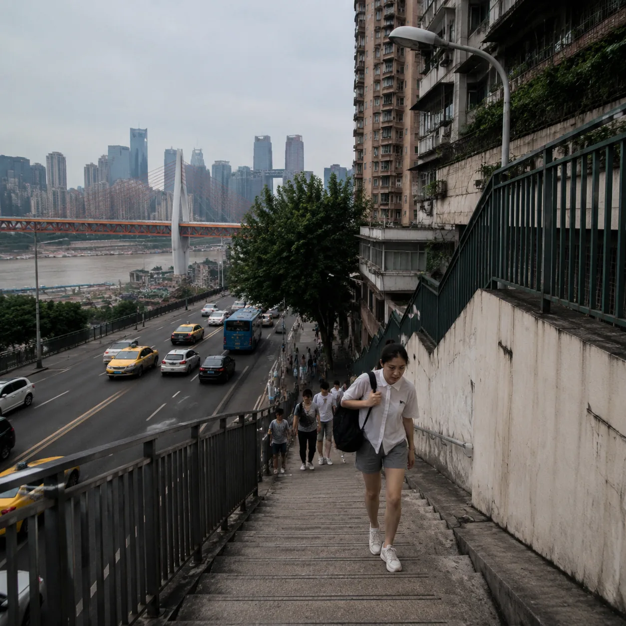
The alley was quiet, with only the sound of a spatula from an upstairs kitchen and a cat slipping along the edge of the steps. The wall was damp, the handrail was worn, and I had to hold it with one hand while pulling my backpack strap higher with the other. Halfway up, I heard someone coming easily behind me: an uncle carrying vegetables. He did not rush to pass. When I stopped for breath, he said, “Take it slowly. This way is close, yes, but it is tiring too.”
That sentence was more accurate than the navigation. The app treated “close” as an advantage, but did not calculate slope, stair height, backpack weight, or the damp heat of the afternoon. After speaking, the uncle passed me with small steps and steady heels. He moved as if walking through a familiar melody, knowing exactly where each pause belonged. Following him, I understood “route” as energy management for the first time, not as a geometry problem.
The stairs did not end at the open intersection I had imagined, but at a narrower cross street. The left side went up, and the right side also went up, only at a different angle. I stood there and almost laughed, because the city seemed to be carefully correcting my flat-map thinking. The navigation said to go right, but I first checked whether there was shade, whether storefronts offered places to pause, and whether traffic would force pedestrians against the wall. A few minutes earlier I had only looked at direction. Now I was looking at conditions.
That part of the walk gave me a concrete feeling for Chongqing’s layers. Not the beautiful three-dimensional traffic often shown in promotional videos, but the real layers under your feet: a first floor may face one road, and a third floor may face another road; you enter through one door thinking you are at ground level, then leave through another and find another slope beneath you. Footbridges, stairs, escalators, tunnels, and alleys are not decoration. They are organs the city has grown in order to live with the mountain.
Later I passed a slope with no shade, where sunlight bounced back from building walls and pressed heat from both sides. Ahead was a noodle shop with a red plastic curtain at the entrance. I went in and ordered a cup of sour plum drink. The owner asked whether I was lost. I said I could find the road; I just had not expected so much upward walking. He laughed and said, “Many places in Chongqing are not far. They are high.” I remembered that sentence because it could almost serve as the first note for traveling in a mountain city.
During ten minutes of rest in the noodle shop, I replanned the remaining route. I no longer chose the shortest path. I chose the one that looked gentler and had shops and bus stops along the way. It added three hundred meters, but made me feel much safer. I took the camera out of my backpack and hung it across my chest to reduce shoulder strain, then moved the water bottle to the outer pocket so I could drink without a long stop. In half an hour, Chongqing changed me from “visitor taking a walk” to “person responding to terrain.”
I began to enjoy this way of reading the city. When looking at a road, I no longer asked only where it led, but how it led there: continuous climbing or down then up; more traffic but gentler slope, or quiet but dense stairs; handrails, shade, convenience stores, and enough width to avoid electric scooters. For someone newly arrived in Chongqing, these questions are more useful than “how many hundred meters remain.”
Near the hotel, I crossed a small footbridge. From the bridge I looked back, and the slopes, alleys, and building faces I had passed folded together like a sheet of paper crumpled and opened again. In the distance, a monorail moved between buildings. Its sound was not loud, but it suddenly gave the space a direction. I finally understood that Chongqing’s charm is not simply that it is three-dimensional. More importantly, that three-dimensionality does not exist just to impress visitors. It is first a living condition that residents pass through, adapt to, and master every day.
The hotel reception was on the fifth floor of a building, but its entrance opened onto another roadside and looked like a first floor. I walked in with slightly aching legs, and the receptionist asked whether I had come up on foot. I nodded. She was not surprised. She handed me the room card, then pointed to the elevator and said that if I went to Hongyadong at night, I could first go down to the second-floor back door and take another road, which would be easier. She said it naturally, as if mentioning the weather rather than revealing a city code.
After entering my room, I set down my backpack and stood by the window looking at the slope outside. The road that had made me breathless now did not look dramatic; it even seemed somewhat gentle. A few cars climbed slowly. A delivery rider parked by the roadside, checked the address, and carried a meal box into the building entrance. I suddenly felt respect for people who live in Chongqing. They do not conquer terrain every day. They negotiate with it every day.
That uphill walk changed the way I traveled during the following days. I stopped packing the schedule too tightly and stopped forcing two places together just because they looked close. Before going out, I checked elevation when possible, or at least looked for many stairs along the route. If the weather was humid, I treated taxis or rail transit as normal choices, not laziness. If I chose to walk, I put rest points into the plan in advance.
I also learned to ask one extra question when asking directions in Chongqing. Not only “How do I get there?” but “Is it tiring to walk up?” “Is there an elevator or escalator?” and “Which side is flatter?” These questions may not sound romantic, but they improve travel quality a lot. Local people often give very specific answers: cut through the mall, take the elevator to a certain floor, avoid that stair lane, go around behind the bus stop. These are answers a map may not give.
Looking back, that uphill road did not take me to a famous attraction, yet it felt more like Chongqing than many attractions. It had heat, slope, shops, stairs, detours, misjudgment, and kind warnings. It made me remember the shape of a city through my knees and breathing. Some understanding in travel is not completed through taking photos. It happens when you slow down, sweat, stop, and choose your route again.
If you visit Chongqing for the first time, I suggest treating the city’s terrain as part of the itinerary, not as background. Do not look only at the straight-line distance between two points, and do not trust the shortest route automatically. Wear shoes that are genuinely good for walking, carry less, and give yourself more time in summer. When you see stairs, look up for the end first. When you see a slope, check shade and traffic before committing. Chongqing is very walkable, but only if you admit it is not flat.
That night I went out for hotpot and chose rail transit plus a short walk. When I reached the restaurant, I did not feel sorry for walking less. Instead, I had more energy to look at the streetlights, smell the soup base more clearly, and hear the laughter around me. What the mountain city taught me was not to avoid walking, but to stop underestimating the road. Once I respected the terrain, the city gave me more details in return.